
Precision and accuracy are vital to the success of any project, from the initial design to final installation. To ensure your solar designs are not only precise but also visually compelling, our solar design tool supports high-quality imagery from industry-leading providers, including Google Maps, Nearmap, Azure, and ESRI. These integrations offer expansive coverage across the U.S. and Europe, giving solar professionals access to the most reliable and up-to-date aerial imagery for your projects.
Let’s explore how leveraging advanced imagery sources can transform your solar design process and help you create high-impact, accurate proposals.
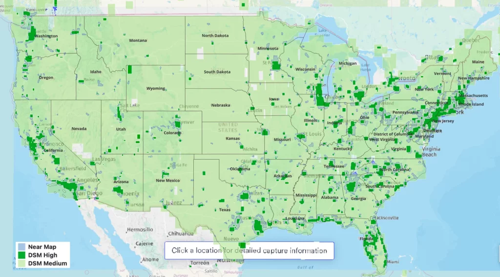
Sources – US
- Google Solar
- Near Map
- Azure Map
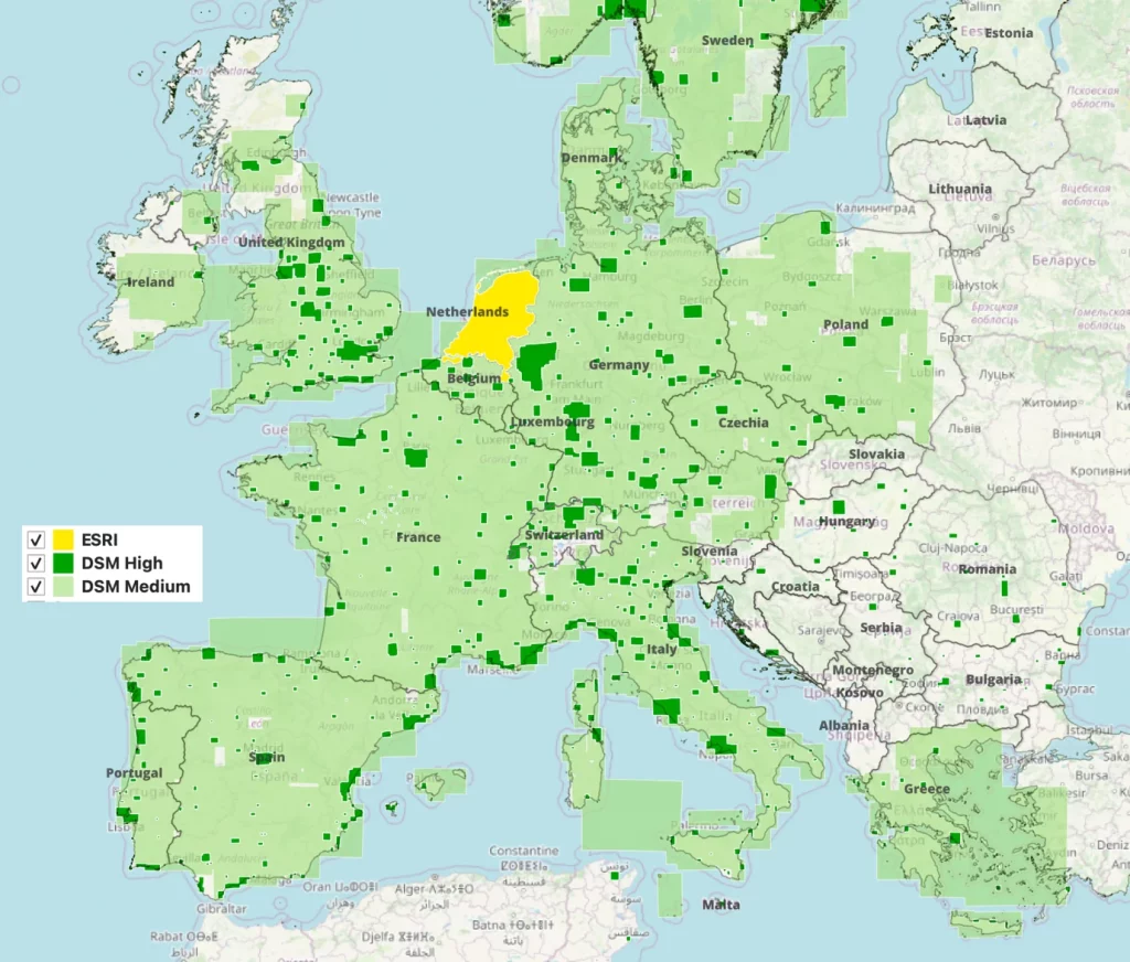
Sources – Europe
- Google Solar
- ESRI Imagery
- Azure Map
Image quality
- Google Solar: Image quality can be based on two types of resolutions.
- High: Solar data is based on high-resolution (10cm) typically from low-altitude aerial imagery.
- Medium: Solar data is based on medium-resolution (25cm) typically from high-altitude aerial imagery.
- Near Map: Very low altitude aerial images with a ground sampling distance of 4.4 – 7cm resolution
- Azure Map: Medium resolution satellite imagery all over US and Europe with a GSD of 30cm resolution
- ESRI Map: Covering Netherlands with 7.5cm resolution
Update frequency
- Google Solar: New data is added all the time, but does not have a refresh rate for specific regions. Some regions use imagery that could be several years old. Refresh rate occurs on an average of 1 to 3 years.
- Near Map: Frequently update the imageries, 3 times in a year.
- Azure Map: Azure maps use satellite imagery which is updated continually.
- ESRI Map: Data refresh happens every 6 months to 1 year.
Coverage
With high quality imagery from Google, Nearmap and Azure, you can confidently design projects anywhere across geographies, ensuring accuracy, compliance, and efficiency.
- Google Solar High: Covers 75% of total populated regions in the U.S.
- Google Solar Medium: Covers 95% of total populated regions in the U.S.
- Near Map: Covers 87% of total populated regions in US
- ESRI: Covers whole of Netherlands
Nationwide reach: From the bustling East Coast cities to remote locations in the Midwest or the vast landscapes of the West, your solar design tool has reliable imagery for any site.
Uniform design process: No matter where your project is located, you’ll have access to the same high-quality imagery, ensuring consistency across all your designs.
Expand your customer base: With nationwide coverage, you can confidently take on projects in any state, growing your customer base and expanding your business footprint.
Integration with multiple image sources adds value to your business
The integration of Google, Azure, and Nearmap with Solargraf brings more than just stunning visuals to your designs—it enhances your entire workflow, from initial planning to final sales presentation.
Save time and increase convenience
With access to detailed, up-to-date aerial imagery, you can perform accurate site assessments and design complete solar systems without the need for an on-site visit. This not only saves you time but also reduces costs associated with travel and manual site evaluations. You can focus on closing deals faster and growing your solar business rather than manually adjusting designs and managing the logistics of site visits.
Realistic visuals to enhance customer trust
When clients can see a detailed, real-life 3D visual representation of their site with panel layouts and energy production forecasts, their confidence in your proposal increases. High-quality imagery helps communicate the value of their solar investment clearly and effectively.
Better decision making
With reliable data, you can make informed decisions on panel placement, system size, and shading impacts, ensuring the most optimized solar designs for any project. This leads to better system performance and greater customer satisfaction.
The integration of Google Maps, Azure, and Nearmap into Solargraf provides solar professionals with the most advanced imagery solutions available. With nationwide coverage, real-time updates, and superior resolution, these tools enable you to create accurate, visually engaging solar designs that inspire confidence and drive more sales.
Whether you’re working on a small residential project or a large commercial installation, the precision and detail offered by these imagery sources will take your designs to the next level. Start leveraging these powerful features today and elevate your solar business to new heights.
Ready to see the difference high-quality imagery can make? Try Solargraf today.
 United States
 Germany/Austria
 Brazil
 Netherlands